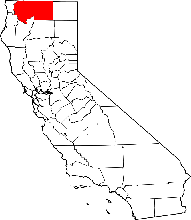
Siskiyou County is located in the extreme north central section of California on the southern border of Oregon.
Driving: Interstate 5, the westernmost Interstate freeway in the U.S., runs from the border of Canada to the border of Mexico, bisecting Siskiyou County along its path. The county may also be accessed by vehicle on US 97 (Central Oregon) and State Route 89 (Nevada and points east), and State Route 96 (upper California coast). It should be noted that inclement weather conditions may adversely affect accessibility during the months of October through April.
Air Travel: The nearest regional airport is located in Medford, Oregon, approximately 40 miles north of the Oregon/California. Rogue Valley International Airport (MFR) hosts four air carriers: America West, Horizon Air, Skywest and United Airlines. Rental car services are available onsite and offsite.
Getting “There”: Geographically, Siskiyou County encompasses an area roughly the size of the State of Connecticut, with more than 65% of the land comprised of national forests with limited access points. To assist visitors, we have developed a “user friendly” description of the distinct regions of our county to assist them in determining the best method (with Interstate 5 as a starting point) of accessing their chosen cycling route. Please note that, due to the topography of the region, it is best to confirm your route before setting forth; oftentimes GPS services are not available in our mountainous and densely-forested area.
BUTTE VALLEY/TULELAKE REGION: Located in the northeastern area of Siskiyou County, this high desert region is home to the communities of Dorris, MacDoel and Tulelake and features the Lava Beds National Monument, site of the Modoc Indian War, and the Tule Lake National Wildlife Refuge, the first national wildlife refuge in the United States. From northbound Interstate 5, travelers may access US 97 at Exit 747 North in Weed, CA; drive northeast approximately 55 miles, turn on to CA 161E and proceed for 20 miles. From central Siskiyou County and Interstate I-5 southbound, take County Route A12 at Exit 766 to US 97 north and follow directions above.
SHASTA and LITTLE SHASTA VALLEYS: This area comprises the north central and east central region of Siskiyou County and includes the communities of Yreka, Montague, Hornbrook, Grenada, Gazelle and Edgewood. Yreka, the county seat, hosts two annual cycling events, the Humbug Hurry-Up Mountain Bike Race and the Siskiyou Century Road Tour. Most communites/routes are easily accessible from Interstate 5 north and south. Edgewood and Gazelle are located slightly off of I-5, along Historic Route 99, a favorite area for cyclists with younger children.
HAPPY CAMP/KLAMATH RIVER REGION: Located in northwest Siskiyou County, this region is home to the river towns of Horsecreek, Klamath River, Seiad, and Happy Camp, located in an area with rich history in gold mining and timber harvesting. This is truly a recreational paradise for cyclists, anglers, backpackers and white-water enthusiasts. Happy Camp is also home to the Karuk Tribe of California…and Bigfoot (or so they say).
To access this region, northbound travelers will depart Interstate 5 at Exit 776, Montague Rd. W., and turn right on to CA Route 263 N to State Hwy 96 W. Southbound travelers will exit I-5 at the Collier Roadside Safety and Rest Area at Exit 786 merging into CA Highway 96W.
SCOTT VALLEY/MARBLE MOUNTAIN/TRINITY ALPS REGION Combining challenging climbs, pastoral beauty and alpine splendor, this region in southwest Siskiyou County is home to the communities of Fort Jones, Greenview, Etna, Callahan, Sawyers Bar, Forks of the Salmon, Cecilville and Somes Bar. Settled by miners and ranchers in the mid-1800s, this area is as rich in history as it is in magnificent scenery. To access this region, north and south bound travelers will depart Interstate 5 at Exit 773 turning west (toward the stoplight) to State Route 3 South (left turn). State Route 3 continues southeast from the town of Etna toward Callahan. To access the “outpost” communities of Sawyers Bar, Forks of the Salmon, Cecilville and Somes Bar, leave CA-3 S in Etna, proceed to Collier Way and turn right at Main Street/ Sawyer’s Bar Road.
SOUTHERN SISKIYOU, MT. SHASTA REGION: At 14,179 feet, Mt. Shasta is difficult to miss! This alpine region is home to the communities of Weed, Mount Shasta, McCloud and Dunsmuir and host to the Castle Crags Century and the Mt. Shasta Summit Century rides.
Most areas of this region may be accessed north bound and south bound along Interstate 5 at the following exits: Historic Highway 99/Exit 751 (routes north to Edgewood/Gazelle, routes south to Weed); Weed, CA, Exit 748 access to US 97 Volcanic Legacy Highway (north Weed), Exit 747 (central Weed) and Exit 745 (south Weed); Mt. Shasta, CA, Exit 740 (north Mt. Shasta), Exit 738 (central Mt. Shasta) and Exit 736 (SR-89 E to McCloud, CA); Dunsmuir, CA, Exit 732 (north Dunsmuir), Exit 730 (central Dunsmuir) and Exit 728 (Castle Crags State Park).